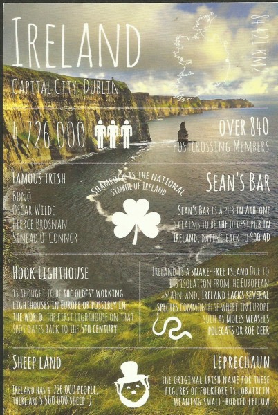
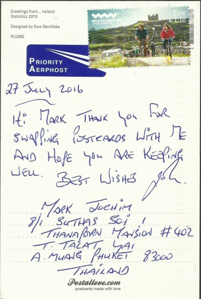
My second country in Postallove’s popular Greetings From series arrived last week from the green isle of Ireland. I love these cards and I hope to be able to obtain all of them someday. This one arrived from John in Newbridge, County Kildare; we arranged the trade on 27 July 2016 but, unfortunately, the stamp failed to receive a postmark. It arrived on 15 August after travelling some 6,390 miles (10,284 kilometers) in 19 days (or less) which is about average.
Ireland (Éire) is an island in the North Atlantic separated from Great Britain to its east by the North Channel, the Irish Sea, and St George’s Channel. Ireland is the second-largest island of the British Isles, the third-largest in Europe, and the twentieth-largest on Earth. Politically, Ireland is divided between the Republic of Ireland (officially named Ireland), which covers five-sixths of the island, and Northern Ireland, which is part of the United Kingdom, in the northeast of the island. The island’s geography comprises relatively low-lying mountains surrounding a central plain, with several navigable rivers extending inland. Ireland has lush vegetation, a product of its mild but changeable climate which avoids extremes in temperature. Thick woodlands covered the island until the Middle Ages. There are twenty-six extant mammal species native to Ireland. The Irish climate is very moderated and classified as oceanic. As a result, winters are milder than expected for such a northerly area. However, summers are cooler than those in Continental Europe. Rainfall and cloud cover are abundant.
The earliest evidence of human presence in Ireland is dated at 10,500 BC. Gaelic Ireland had emerged by the 1st century AD and lasted until the First World War. The island was Christianised from the 5th century onward. Following the Norman invasion in the 12th century, England claimed sovereignty over Ireland. However, English rule did not extend over the whole island until the 16th–17th century Tudor conquest, which led to colonization by settlers from Britain. In the 1690s, a system of Protestant English rule was designed to materially disadvantage the Catholic majority and Protestant dissenters, and was extended during the 18th century. With the Acts of Union in 1801, Ireland became a part of the United Kingdom. A war of independence in the early 20th century was followed by the partition of the island, creating the Irish Free State in 1922, which became increasingly sovereign over the following decades, and Northern Ireland, which remained a part of the United Kingdom. Northern Ireland saw much civil unrest from the late 1960s until the 1990s. This subsided following a political agreement in 1998. In 1973 the Republic of Ireland joined the European Economic Community while the United Kingdom, and Northern Ireland, as part of it, did the same.
Irish culture has had a significant influence on other cultures, especially in the fields of literature and music. Alongside mainstream Western culture, a strong indigenous culture exists, as expressed through Gaelic games, Irish music, and the Irish language. The culture of the island also shares many features with that of Great Britain, including the English language, and sports such as association football, rugby, horse racing, and golf.
My trading partner for this card lives in Newbridge which is officially known by its Irish name An Droichead Nua, meaning simply “The New Bridge”, is a town in County Kildare, Ireland. Its population of 21,561 (2011 census) makes it the largest town in County Kildare and the fifteenth-largest in Ireland. Settlement in the area dates from the the foundation of Great Connell Abbey in 1202 by the Augustinian Canons. The current town lies on the banks of the River Liffey and is made up of six ancient parishes and portions of others. The earliest known mention of Newbridge was by traveler and bookseller John Dunton in 1698, though he does not refer to any settlement other than at Ballymany. A Roman Catholic chapel was built beside the bridge about 1730 and the New Bridge Inn was in existence in 1750. The first bridge was destroyed by floods in 1789 but was rebuilt it the following year. The origin of the modern town lies in the establishment of Cavalry Barracks (1815–1819) on land purchased from three local landlords. Little of the barracks remains today except old walls and gateways. From 1819 various cavalry regiments were stationed at Newbridge and brought much business to the town.
Newbridge expanded rapidly after the Curragh Camp was established in 1855. Eyre Street (named after the local landlord Eyre Powell) and Edward Street (named after Prince Edward, later King Edward VII, who was stationed on the Curragh at the time) were built in the years 1855 – 1870. The new railway opened in 1846 and churches were built to cater for the increasing population. A National School was opened on the Railway Road in 1842 and a boarding school at the Dominican Friary in 1852. The town continued to prosper until the withdrawal of the Cavalry in May 1922 on the establishment of the Free State. It went into a period of decline thereafter, but since the 1960s has seen considerable growth and has become a busy shopping and commuter town. Today Newbridge is a thriving town with a population approaching 22,000, a major center for industry and commerce, within the South Kildare region.


